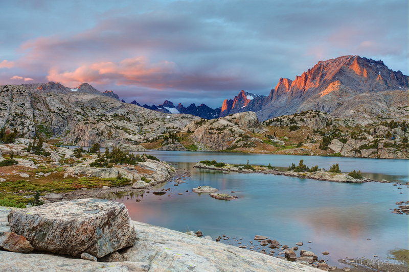
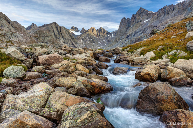
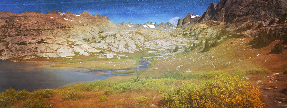
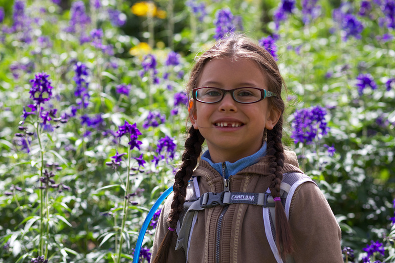
 Titcomb Basin Refection
Yesteryear
About 20 years ago, I had the joy of visiting the Wind River Range in Wyoming with my friend, Shelly Stokes (I know, Shelly, I need to write more often...). She is now Shelly Vanhouwelingen, married to a great guy who happens to be an awesome Sheriff in Fresno County. Shelly played softball at Fresno State, then went on to be a gold medalist on the 1996 U.S.A. Olympic Softball Team. Anyway, we decided to head to Wyoming to tackle the Winds and climb Fremont Peak. It was a blast, and really one of the adventures that opened my heart to really wanting to get serious about photography. Below is a photo taken of Shelly on a grassy ledge when we descended Fremont Peak's west side straight down to Titcomb Basin. NOT recommended, as we had to navigate a pretty precipitous series of ledges and drop-offs! We kept praying the ledges would continue down, as we were certainly not going to make it back up the way we had come!
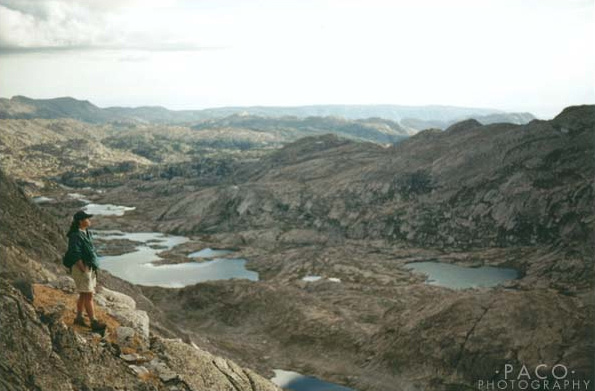 Shelly on descent of Fremont Peak
Fast-forward 20 years, and one photo of Titcomb Basin began haunting me, waking me up to the fact that I really, really wanted to go back with a dSLR in hand. Here's the photo (my gratitude to OldManTravels for taking it and posting it online!).
The time had finally come.
Getting There
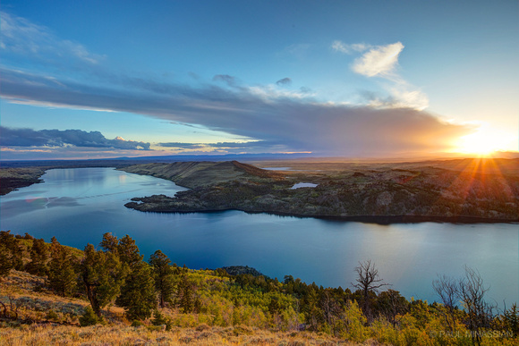
Some wouldn't know this, but I actually like driving... when in open spaces. Once I got past Fort Collins, Colorado, and headed into Wyoming, I was loving it. The short road from Pinedale, Wyoming, to the trailhead followed along the shore of Fremont Lake. I remembered it from all those years ago, and thought I'd like to take a stab at a sunset shot at the lake. God did not disappoint...
Day 1 - Elkhart Park to Island Lake
So I hadn't decided if I should hike in a few miles and set my sights on the high country the following day, or head all the way to Island Lake (almost 12 miles) the first day. I decided to shoot for Island and see if I could make it.
The first few miles were extremely uneventful. I hiked through a forest. A forest much like most forests I've hiked through. So monotonous, I figure instead of showing you photos of said forest, I'd ask my young daughters to draw pictures of a forest, which might be a bit more entertaining. The photo is at Photographer's Point with the pictures they drew for me and told me "not to open until hiking." I LOVE MY GIRLS!
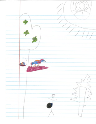 Forest Hike by Ryan (that's a backpack, not my belly!)
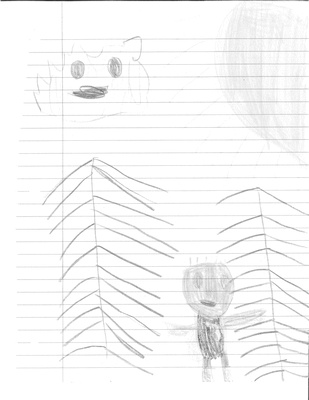 Forest by Logan
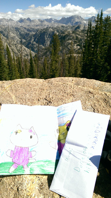 Drawings for the trail (from my girls)
Feeling Young
So I guess I was hiking fast; the 4.5 miles to Photographer's Point went by much quicker than I thought. I had some pep to my step, feelin' like I was young again.
Things were starting to look good the closer I got to Island Lake. Some pretty nice scenery along the way...
Feeling A Bit Older
Once I got passed Seneca Lake, I was starting to feel it a bit. There were a lot of ups and downs on the trail, which I had expected, and nothing as hard as the constant "up" you have to hike in Colorado to get to the high up places. However, I did have to laugh at myself when I said, "Oh, here's the last rise, then I'll be at the lake!" only to realize there was one more down-and-up to go. :)
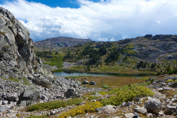 Looking back toward Lester Pass
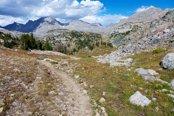 Getting warmer...
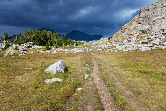 warmer...
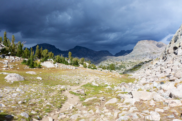 warmer...
Feeling Old
Once I was at Island Lake, I pitched camp quickly as the hail was about to let loose. I caught a few sprinkles, but was snug in the tent when it opened up. And I was tired. Maybe I had bitten off more than I could chew...?
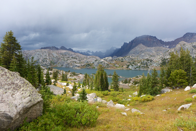 Island Lake... finally!
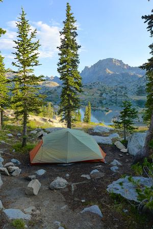 Campsite at Island Lake
Island Lake Sunset
The sky was clouded over pretty densely up until sunset's golden hour, and I was hoping (praying) that the sky would open up at some point. I was almost resigned to full clouds when a small window opened up, and God said "yes" and painted a beautiful scene...
Island Lake Sunrise
There were no clouds just before sunrise, so again I prayed for some clouds to form as well as the wind to stay calm. I know, lofty hopes. But God once again said, "yes" and revealed yet another beautiful scene...
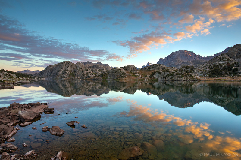 Island Lake Sunrise
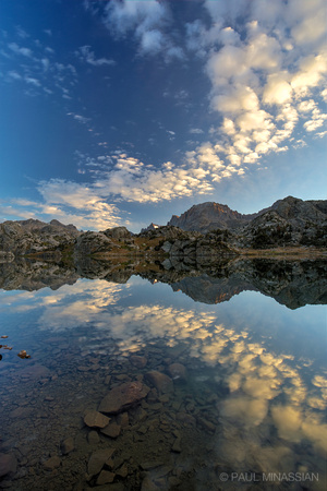 Morning Sky at Island Lake
Day 2 - Island Lake to Titcomb Basin
It's funny what can get lost over 20 years. We came down this trail all those years ago, but I don't remember a foot of it. So it was a very nice "rediscovery" as I enjoyed a pleasant hike up to the basin.
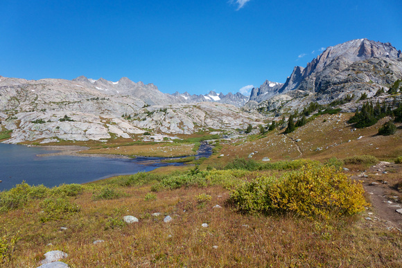 Between Island Lake and Titcomb Basin
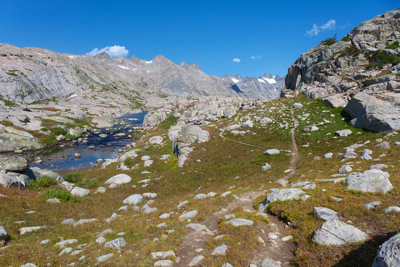 Approaching the basin
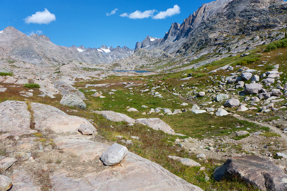 First look at Titcomb Basin!
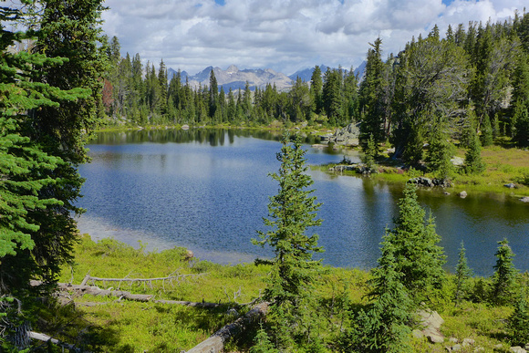
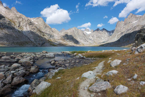 Approaching Upper Titcomb Lake
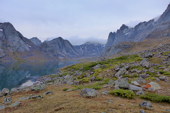 Campsite at Upper Titcomb Lake (tent bottom right corner)
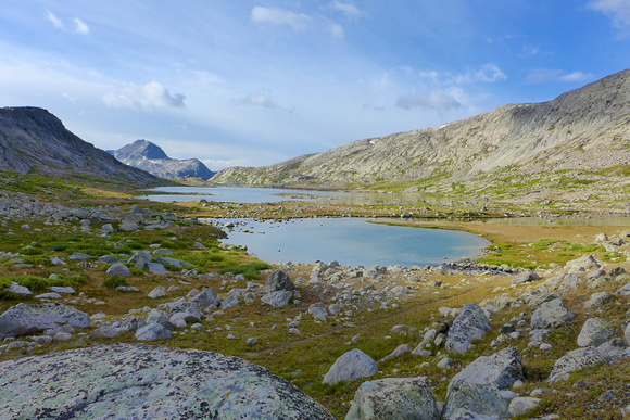 Looking south back down the basin
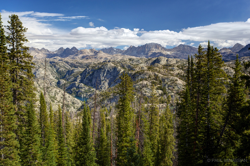
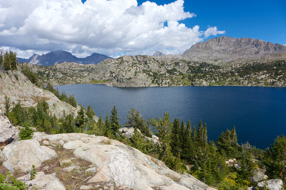
Titcomb Basin
Here it is: the goal of my journey. The place I've wanted to see again for 20 years.
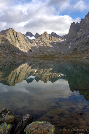 Upper Titcomb Reflection
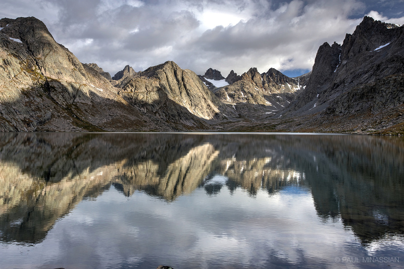 Upper Titcomb Lake
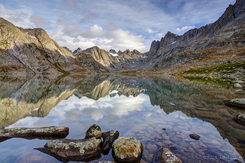 Upper Titcomb Morning
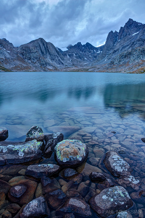 Titcomb Basin Blues
Day 3 - Limitations
My plan was to spend another day in the basin, then go back toward Seneca Lake, head over Lester Pass and down to Upper Cook Lake, spend the night there, head out to the trailhead, shower in Pinedale's Aquatic Center, drive to the Big Sandy Trailhead, hike to Deep Lake, then over to Temple Lake, then out and drive home.
However...
1. My shoes (and subsequently feet) finally failed me. I'd been using Inov-8 Roclite 315's, which had worked fine on shorter hauls in Colorado, but the miles and miles on granite trails in the Wind Rivers was too much for my toes. Even as I type this, I look down at still-swollen big toes (both feet) with black toenails that will no doubt fall off sooner than later. Perhaps I didn't have my shoes tied just right, but my toes took the brunt of the miles. As well as the arch on my right foot, which was hurting rather consistently as I hiked my last 20 miles over days 3 and 4. For years I hiked in Hi-Tec Altitude I's (the original); I think I'll go back to Hi-Tec Alititude V's (they have a low-top I might try), give those a go.
2. My appetite continues to cause problems. For whatever reason, the last couple times I've backpacked, I've found it difficult to eat whatever food I have with me. Due to camera gear, I've left the stove at home, but I think I may have to go back to bringing a stove and bringing things like Top Ramen, instant oatmeal and such. My stomach actually rejects food and doesn't let me swallow. It's very strange, but I'm sure it has something to do with pushing my ever-aging body much too hard on my first day, which then effects all the rest. I'm not getting nearly enough calories into my gut, and it really drains me.
So between the two issues, I decided to head out the way I came in, bypassing Lester Pass and camping up on a ridge above Lake Hobbs. Once I got out I then chose to head north to Grand Teton National Park and spend a few days taking a few photos and enjoying God's amazing creation.
Grand Teton National Park was wonderfully, beautifully, peacefully uneventful. Except for my pre-dawn hike to Taggart Lake on the same day they closed down the Moose-Wilson Road due to heightened grizzly bear activity. I sang variations of "This Little Light of Mine" (stuck in my head because I sing it to my daughter Logan a lot when tucking her in to bed) quite loudly and boldly as I hiked through the dark by headlamp. It must have worked because I'm still alive. :)
The Little Things (Are Sometimes the Biggest)
This is cool (albeit random)... a sun hail shower (video), and coming home to two amazing little girls!
Sun hail shower
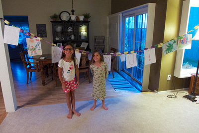 My "Welcome Home" moment—I love my girls!
Ahead of Time
The thought is as simple as it is profound: I will not be able to visit places like this forever. Praise God I have my health, but He never promised me good health all my life (nor do I expect Him to). If I'm completely honest with myself, I know the day will come—sooner than later—when I won't be able to do this anymore. At least not with 10 pounds of camera gear. And who knows what else might be in store around the bend.
I used to look back and think, "If only God had let me know ahead of time, I would have been prepared for this or that." Ahead of time. Such an interesting phrase. When I really think about it, the only one who should be "ahead" of time is God. Not me.
When I hike down a new trail for the first time, I never know what's around each bend, or over each rise. That's a good thing. A great thing. There's a sweet mystery to it, never knowing what amazing landscape I'll encounter. I don't round each bend thinking, "Wow, it's probably going to be ugly around this bend with lots of mosquitoes and it'll probably hail on me and be freezing and the trail will probably be a pain and steep." I wouldn't get a mile down a trail if that's how I looked at it. So why not have the same attitude about my life? Do I not believe Jesus Christ leads me down each trail? And if He does, why not look at the right side of the picture? There is always something amazing and beautiful and unique to be found out on the trail. Always.
I've had some tough moments—even some scary, dangerous moments—on the trails I've hiked. One of these days, I might end up in a bad situation, one that may debilitate me. But even if I ended up hurt from a fall on a hike, and life got incredibly difficult, it wouldn't make me despise the "location." Meaning, the mountains (deserts, etc.) would not lose one ounce of their spectacular beauty, even if I could never hike in them again. Likewise, I've had some tough, scary moments in life. Even a bit debilitating. I have a few scars that will always be with me, and I don't know what awaits around the bend. But I think this trip made me realize, even if I collect brutal scars over the years, it won't make me despise what Jesus has done. And what has He done? He's offered a "location" in which I have the freedom and permission to approach Him, to have a relationship with Him in spite of my failings (read: sins). That location? His presence! The more I "hike" in this life, the more I realize that Jesus Christ is the spectacular beauty around each bend. And that will never change, no matter how many times I stumble along the trail.
"We can make our plans, but the Lord directs our steps." - Proverbs 16:9
]]>
 Sneffels Range from County Road 7
With the blessing of my wonderful wife, I headed to the north end of the San Juan Mountains in hopes of getting some good fall color photos. I was reading in multiple blogs and reports that the colors weren't very good this year. So hesitantly I went out, hoping it wasn't as bad as I was led to believe.
God's creation (as usual) did not disappoint. I'm finding there will always be beauty out there, even if it means finding something unique to enjoy. I have to remind myself that even if the shot isn't there, the beauty is. Our eyes can process such amazing things that our cameras can't even begin to capture.
County Road 5
The trip started with sunrise on County Road 5 overlooking the Sneffels Range...
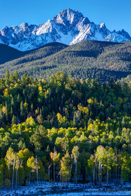 Mount Sneffels from County Road 5SAN JUAN MOUNTAINS, COLORADO
County Road 7
Once the sun was up, I headed over to County Road 7. I had been on the road a couple years ago when heading to the Blue Lakes, but I drove it at night and had no idea what awaited me...
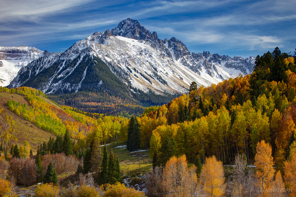 Mount SneffelsSAN JUAN MOUNTAINS, COLORADO
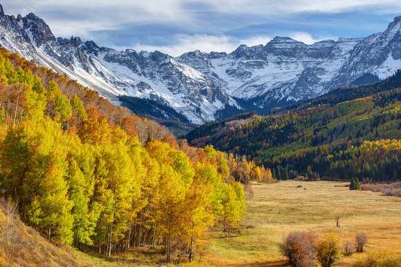 Willow Swamp, Sneffels RangeSAN JUAN MOUNTAINS, COLORADO
Again, I realize this is a "bad" year for colors, but I don't care. I thought it was beautiful. It reminded me of the Valley of the Ten Peaks in Banff.
Last Dollar Road
Next I headed up and over the pass along Last Dollar Road. Having never been on the road, it was an enjoyable drive. I always thought it would be a harder drive, but it was easy, and not too much snow up on top. Once over the top, I found some very pretty aspen groves on the west side of Whipple Mountain...
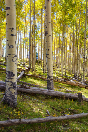 Whipple Mountain AspenSAN JUAN MOUNTAINS, COLORADO
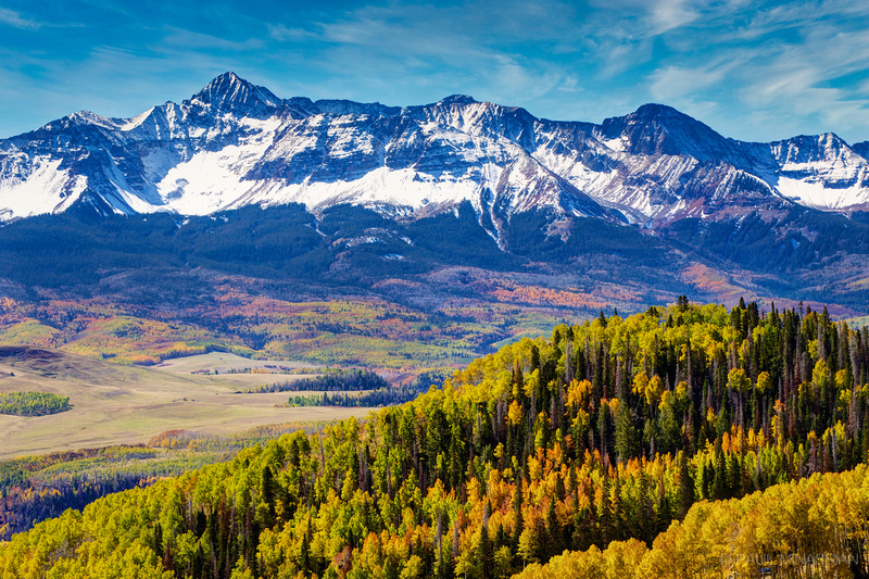 Mount Wilson from Last Dollar RoadSAN JUAN MOUNTAINS, COLORADO
Back to County Road 7
After that I decided to spend the night back on County Road 7 to attempt my first star photography, then catch the dawn...
Yes, I have a lot to learn about star photography. When I got home I read some tutorials on it, and I'm already chomping at the bit to head back out and give it a go for some better results.
As I headed out of County Road 7, I thought I'd check out a spot another photographer was at the afternoon before. I am so dumb. Had I know there was a beaver pond there with great potential for reflection, I could have gotten an awesome shot with the afternoon sun on Mount Sneffels. Sigh. Oh, well, it was still a nice shot in the morning (when the wind wasn't blowing)...
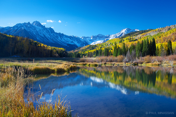 Beaver Pond in Willow SwampSAN JUAN MOUNTAINS, COLORADO
Owl Creek Pass
After sunrise at County Road 7, I headed up and over Owl Creek Pass...
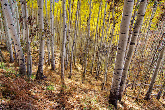 Owl Creek Pass Aspen
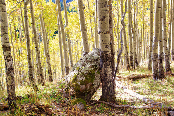 Rock Aspen
A very talented photographer (Jack Brauer) had taken some wonderful shots of Chimney Rock and Courthouse Mountain, so I headed into the forest to look for a similar view. I think I found it...
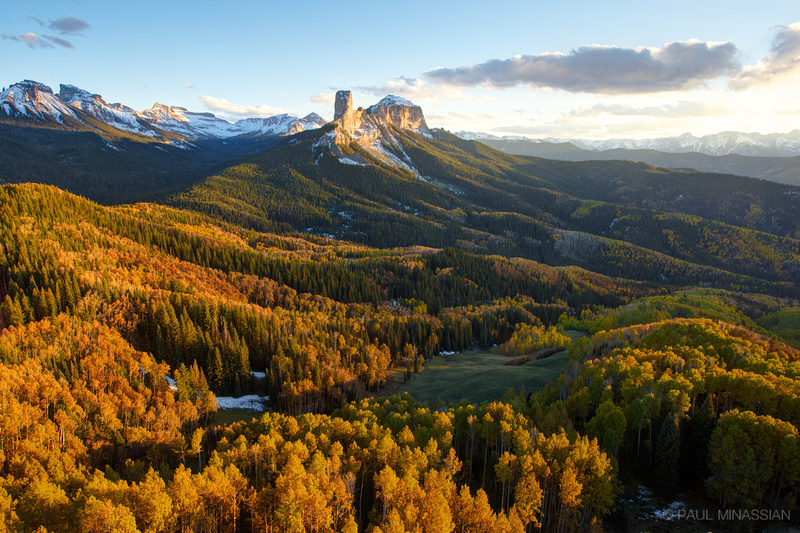 Courthouse Mountain
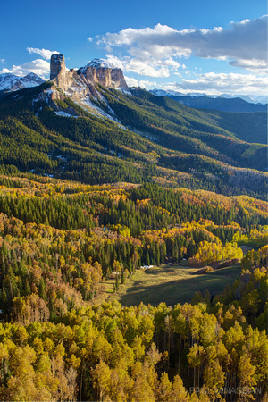 Afternoon near Owl Creek Pass
I put together a couple panoramas of it, using a very nice program called DoubleTake that works well with Aperture if you want to get it done quickly...
So in the middle-of-nowhere, thinking I would be the only soul around, up out of the forest comes a guy and a gal with the same idea I had. He was very unassuming, but it turns out he is a very talented photographer (Toby Harriman). If you get a chance, check out his awe-inspiring time-lapse video work.
911
Hiking back was interesting. I followed a barbed-wire fence through the dark back to where I was parked. Fell a couple times, I admit. I made one big mistake, though: I didn't ask the two photographers (Toby and his friend) if they were prepared to head back in the dark! I saw them heading down the hill to the west, and earlier he had said he didn't relish following barbed wire in the dark, so I put 2+3 together to make 4 and assumed they were going to try to reach the road to the west in the dark. I didn't know if they had flashlights, nor realized how far it was to the road that way. So I decided to wait until they reached their car. It was 8pm when I got to my truck, and the wait began. After an hour (dark this whole time) I began honking my horn and shining my mag light into the trees. I then started driving the road on the west side, honking, stopping, flashing my brights. I did this several times, and was getting increasingly worried about them. Finally I decided (after 2 hours back at the truck) to call 911 and ask for a local sheriff's number just in case (I had reception where I was parked). Just as I was talking with 911, I see light bobbing up and down on the road. It was them. Turns out (as I found out later) Toby knew was he was doing. They had headlamps and warm clothes, and had stayed to shoot the stars after dark. So they weren't heading down to the west to find the road, they were just heading to a vantage point a bit below the ridge for the star shots.
Boy, did I feel dumb. :)
The Milky Way
It was now 10:30pm (after the 911 debacle), and I had to make some decisions about where I was going to head next (and where I was going to sleep). I had promised my daughters I'd take a picture of the Milky Way (which we had introduced to them on our summer camping trip to Mesa Verde National Park). so I decided I might as well give it a go...
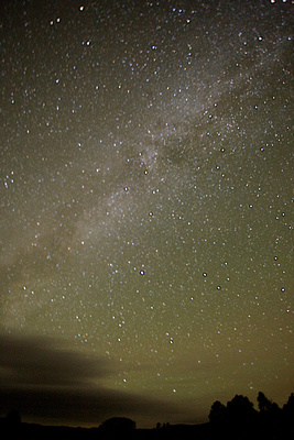 The Milky Way near Dallas Divide
Yep. LONG way to go to get this star thing right. :)
Rifle Falls
After all the fun, I still had one day left on the docket. The original plan was to spend the night at Owl Creek Pass, then stay in the San Juans until nightfall, then drive home through the night. However, I decided I had already gotten some nice shots, and wanted to see my wife and li'l girls before they went to bed. So I changed plans and chose to head to Rifle Falls State Park to sleep (got there at 3am), take some morning shots then head home. I had never seen the falls, and was curious if they were worth photographing or if it was just a big tourist trap with cement walkways and such. In my opinion, it's a beautiful location...
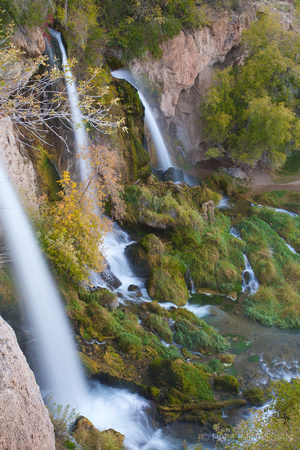 Rifle FallsFLAT TOPS, COLORADO
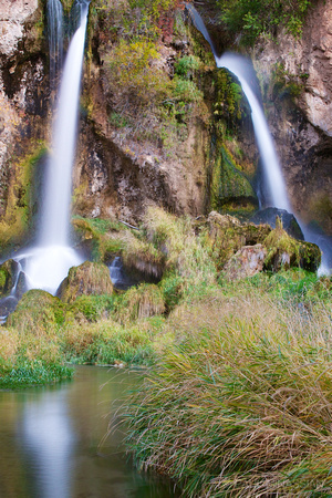 Rifle Falls ReflectionFLAT TOPS, COLORADO
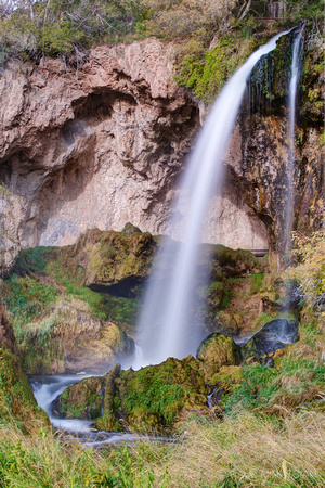 Rifle Falls IIFLAT TOPS, COLORADO
ISO 1250
I am pathetic. Remember how I took some shots of the Milky Way the night before? Yeah, well I had set my camera to ISO 1250 for those shots — and never reset it to 100! No!!! So I took a bunch of shots of Rifle Falls, and on my LAST SHOT (no exaggeration), I noticed the ISO. Really. Really? Huge sigh. Then choice words. Then a smile and laughter. I can be so dense sometimes! At times like that, you just gotta laugh. The sun had already broken through, so the soft light was gone. Thankfully, for these particular shots the high ISO didn't seem to do much damage. I'm so glad I have the camera I do (Canon 6D, GREAT with high ISO) and that I didn't set my ISO as high as I should have for the star shots the night before! :)
Eagle River
After the ISO Madness at Rifle Falls, I finally headed home. I was cruisin' along I-70 nearing Gypsum when I noticed some really nice colors in the cottonwoods along Eagle River. I passed a beautiful grove, then hesitated at the off-ramp to Gypsum, then argued with myself (not wanting to hit afternoon traffic in Denver), and finally gave in at the Eagle off-ramp. I turned around, headed back and found this lovely grove...
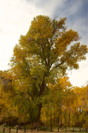 Eagle River CottonwoodEAGLE RIVER VALLEY NEAR GYSPUM, COLORADO
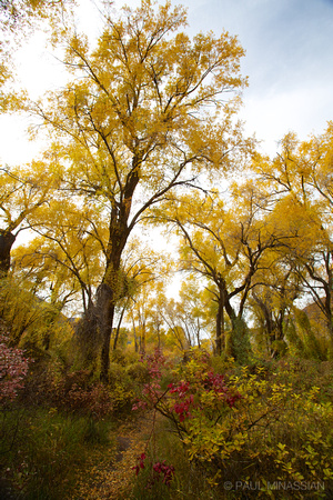 Cottonwood PathEAGLE RIVER VALLEY NEAR GYPSUM, COLORADO
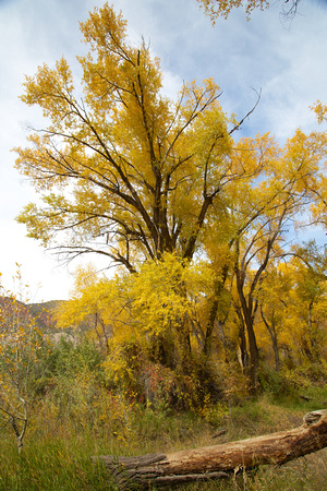 Fall Cottonwood
Funny thing is, it's some sort of federal land area, so there's usually a fee. Due to the government shutdown, however, the gate was locked but the sign posted basically said "Enter at your own peril. No toilets or emergency assistance." I figured I could handle it. :)
Final Thoughts
All in all? For a year that supposedly had "bad colors" and "the worst Dallas Divide colors ever seen," I thought God did quite a nice job of it.
]]> Storm King Peak over Trinity Lake
This trip originated with the goal of Sunlight Basin. The end result was bittersweet; inclement weather made for a change in plans, but the end result definitely made for a memorable trip...
Getting There
Sunlight Basin is located in the heart of the San Juan Mountains. More specifically, in the Needle Mountains. I had some other destinations in the San Juans before my backpacking leg, so my trip started near Lake City at a camp called Redcloud, where my wife and li'l girls were attending a family camp while I traipsed around the San Juans. See "Destination: Sunlight" for more on the other legs of my journey.
I parted from my family at American Basin along the road to Cinnamon Pass. I went over Cinnamon Pass, then headed down to the Cunningham Creek drainage and Stony Pass. Once over Stony Pass, I dropped down into the valley of the Rio Grande, then up a rough road to Beartown Trailhead. It was definitely a tough road, but I was very impressed with how well my stock 4Runner handled it all.
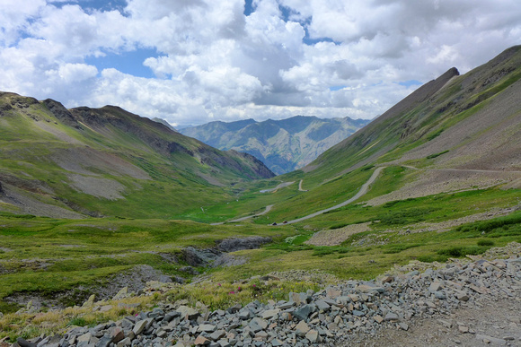 Stony Pass looking north
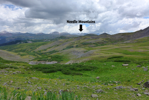 Stony Pass looking southwest
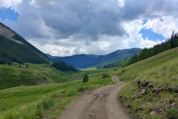 road up Bear Creek (to Beartown)
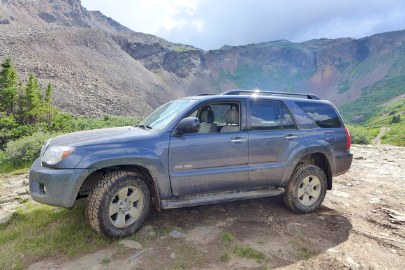 4Runner at Kite Lake
My plan was to start out at Beartown Trailhead, head over Hunchback Pass, down into the Vallecito Creek drainage, up Trinity Creek, up to the crest of the Needle Mountains via Lake Silex, traverse south along the crest past Leviathan Creek drainage, then over the east shoulder of Jagged Mountain to Sunlight Basin. The way back was down Sunlight Creek to Vallecito Creek, then back up Vallecito Creek to Hunchback and Beartown Trailhead.
The Beartown Trailhead is actually right along the route of the Colorado Trail. The trail headed up and over Hunchback Pass, then down into the Vallecito Creek drainage. I think they call it Hunchback because the top of the pass is wide and flat. This caused me some concern on my way back over (I'll explain later). The pass itself from Beartown was fairly easy.
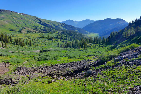 looking east down Bear Creek from trail up Hunchback Pass
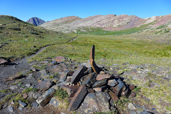 Hunchback Pass
Heading down into the Vallecito Creek drainage was pleasant and offered the first views of the Needle Mountains, which was exciting.
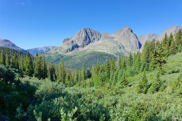 looking south from Hunchback Pass
The hike was easy down to Vallecito Creek, where I found a beautiful waterfall and cascade...
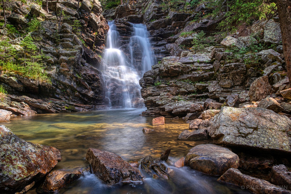 Falls on Vallecito Creek
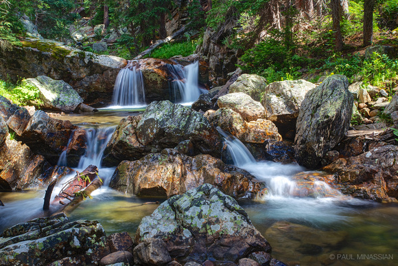 Vallecito Creek CascadeSAN JUAN MOUNTAINS, COLORADO
This is where things started to go a bit sideways. I wasn't sure how to get to Trinity Creek, as I knew heading to where Trinity Creek runs into Vallecito isn't the right place. As I headed down the trail looking for some sign of the use trail up Trinity, the rains started (before noon). After a lot of staring at the map and second-guessing, I decided the trail was somewhere along my back trail. I ended up back at the beautiful waterfall, and (thankfully) three hikers were just coming out from Trinity. Turns out — and here's where I laugh at myself — the trail up Trinity Creek is right where I was standing taking the photo of the waterfall! I felt sheepish.
I'd love to say the hike up Trinity Creek was pleasant, but it wasn't. The trail was fine to follow for a bit, not too many deadfalls and such, but soon it ran into a large meadow. And at that point, I lost the trail. It wasn't until my way back down the next day that I figured out where the trail emerged from the meadow (more on that later). So I spend the rest of the afternoon blazing a trail in miserable rain up the middle of the drainage, but the trail was more to the left (south). If you go up Trinity Creek, stay left! And did I mention it was raining? Here's a clip of the fun...
I finally go to Trinity Lake in the evening. It had rained the entire time, including while I set up my tent. After camp was set up, I slept on and off until around 10pm, when I set my alarm for 3:30am and went to sleep for good.
3:30am
Why such an insane wake time? To climb up the high point between Peak 3 and the Trinity Peaks. I "snoozed" a bit too long after the alarm, and didn't end up starting out until after 4am. Most of the hike was by headlamp. The ridge itself was a very loose scree, which can be a bit of a 3 steps forward, 2 steps back affair. But, at least it was a safe climb, no crazy, crumbling rock cliffs with which to contend. Still, I was scrambling, huffing and puffing because I could see the light starting to show, and I had to get to the top quickly!
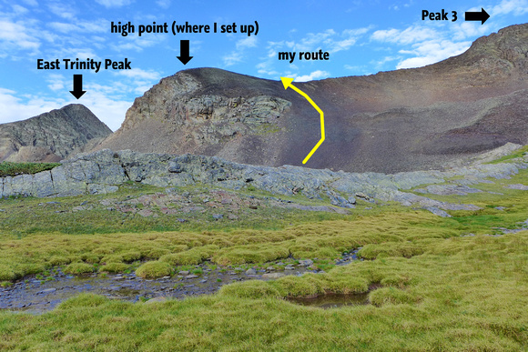 high point where I took photos
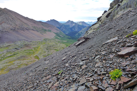 looking down Trinity Creek from scree
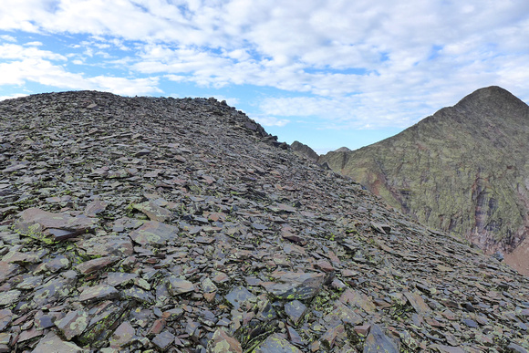 eternal scree
The View
I'll let the images speak for themselves...
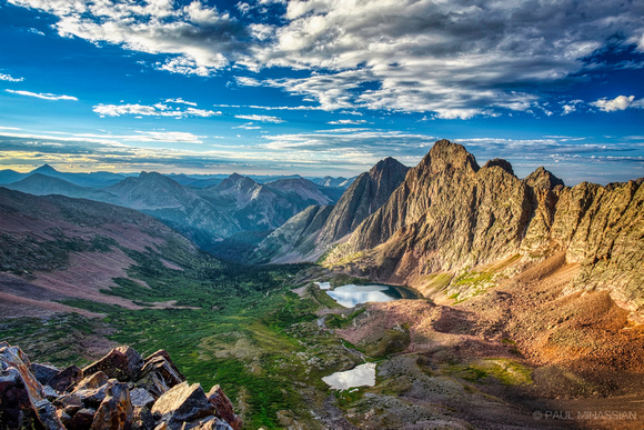 Sunrise in Trinity Basin
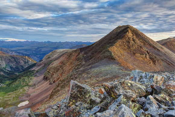 Peak Three Sunrise
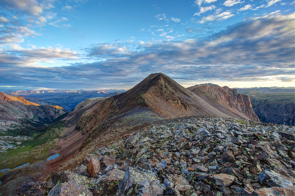 Dawn at Peak Three
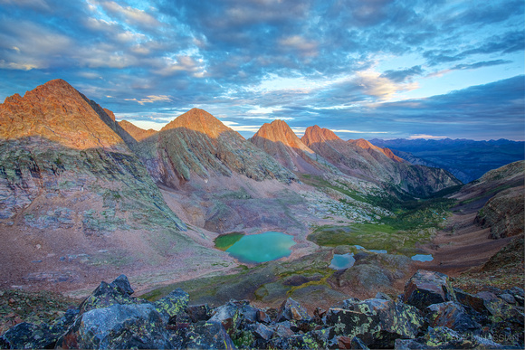 Grenadier Sunrise
 panorama of the Trinities and Grenadiers
High Up in Trinity Basin
Heading back down to the tent was probably the most pleasant part of the trip. The isolation was nice, and there were a series of flat grass parks that were very pretty...
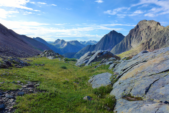 alpine park high up in Trinity Basin
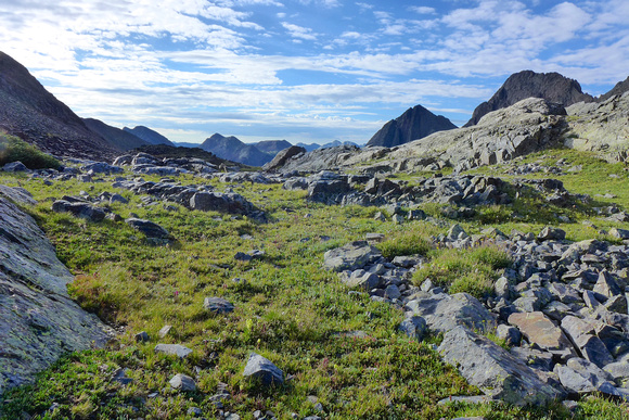 high up in Trinity Basin
The Decision
By this point I had been in the San Juans for almost a week (see blog post "Destination: Sunlight"), and it was very apparent that most days would see several hours of steady lightning/rain — much more than the typical fare from years past (which saw maybe 1 1/2 to 2 hours in the mid-afternoon). My plan to head along the crest of the Needles gave me pause. I had to get down to my tent, pack up, head up and over the pass west of Lake Silex and get at least as far as Leviathan Lake before the thunder and Lightning hit. I honestly just didn't know if I would make it, and definitely knew it wouldn't be safe. Disappointed, I knew I needed to stay within my limits and call it off. I bid adieu to the Needles, and headed back down Trinity Creek...
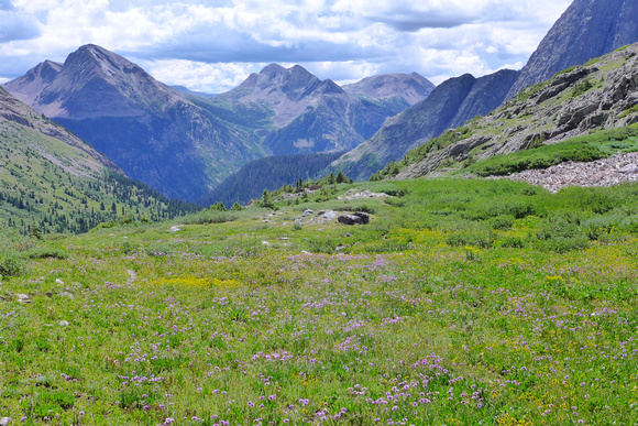 wildflowers near Trinity Lake
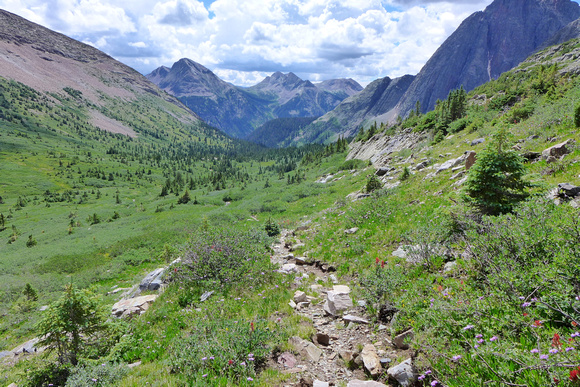 trail down Trinity Basin
The Journey Back
Well, turns out the trail stayed to the south in the drainage. When I arrived at the meadow way down the creek where I had lost the trail, I realized that the trail had crossed straight down the middle of the meadow and disappeared into a thick stand of willows. I had actually scouted within a few feet of the trail at those willows, but missed it. So I tried to set up a couple cairns. Hopefully the next hapless soul won't make the same mistake I did heading up the creek.
By the time I reached the Vallecito, it started raining again. Pouring, actually. I sat under a thick fir for a bit to eat lunch and rest, then headed toward the pass. It was a LONG trip back up the 2500+ feet to Hunchback Pass. It rained the entire time, although it was a steady rain, no more downpours. At one point I had to walk across a very wet log to cross a deep, swollen creek — scariest part of the trip. The rocks I had crossed over coming in were well under water at that point.
As I neared Hunchback Pass, thunder was booming all around. I had a decision to make. If I headed up and over the pass, I'd be back to the truck that night and not have to set up camp one extra night (in the rain). This meant heading over a 12,400 ft. pass in late afternoon — not the smartest thing to do when in the San Juans. And since Hunchback Pass is long and flat and the ridges around it aren't much higher in elevation, it meant a lot of exposure. So I prayed quite sincerely, "Lord, I know this might be foolish, but I'd love to get home to my family earlier than planned since my trip is cut short. Would you please keep the lightning at bay as I go over this pass?" As a parent, there are time I realize my children are making a bad decision, but I choose to protect them within it anyway. I think God did that for me. The hour leading up to the pass, over the pass and down the other side, not one flash of lightning was seen nor rumble of thunder heard. I got back to the truck just as the steady rain turned into a downpour (and the lightning and thunder started right back up where it left off), thanking God for keeping me safe on another great journey.
Final Thoughts
Sometimes I wonder if I should have tried to head down to Vallecito Creek, then down to Sunlight Creek and up into Sunlight Basin. But then wisdom reminds me that it would have been extremely difficult, and I made a wise decision. I remind myself that falling short of a goal is not a bad thing, especially when weighing the dangers involved in overdoing it. My wife supports my solo journeys, and in return I've promised her that I would always weigh carefully how far I'd push myself.
I think it's a lesson God has tried to teach me a lot, but I can be pretty stubborn. He doesn't expect me to conquer all obstacles — He's the Conqueror, not me. My attempt at conquering a particular route on the backbone of a mountain range is neither here nor there in light of what Christ conquered for me — something I couldn't conquer by my own strength. If you feel led, check out Romans 8. If you don't want to read that much, try just Romans 8:14-39. Still too much? Then just read the next sentence, for all who choose to surrender to the Loving Conqueror, Jesus Christ:
"For I am convinced that neither death nor life, neither angels nor demons, neither the present nor the future, nor any powers, neither height nor depth, nor anything else in all creation, will be able to separate us from the love of God that is in Christ Jesus our Lord." (Romans 8:38-39)
]]>Porphyry Basin
There's no shortage of photos of this basin on the Internet, but I wanted to see it for myself. The water was a bit down, but it served to challenge me to try to get some neat shots...
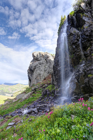 Porphyry FallsSAN JUAN MOUNTAINS, COLORADO

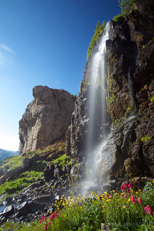 Sunrise at Porphyry FallsSAN JUAN MOUNTAINS, COLORADO
What a beautiful basin! I spent the night up there. The only problem I had was a persistent porcupine who really wanted to gnaw on my truck's hoses. Not good. I chased him off with some nice sized rocks, but it definitely persuaded me to purchase some mothballs in the general store in Silverton before heading out to Beartown trailhead. The afternoon shot below (left) is Red Mountain. The morning shot below (right) was taken from the basin, looking across the million dollar highway over to the Grenadiers in the distance — where I'd end up in just a few days...
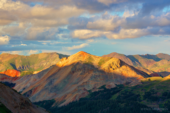 Red Mountain
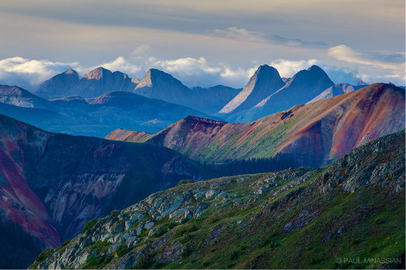 Grenadier HorizonSAN JUAN MOUNTAINS, COLORADO
South Fork Mineral Creek
The next day I headed down to spend a bit of time at the South Fork Mineral Creek...
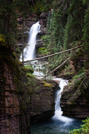 Falls on South Fork Mineral CreekSAN JUAN MOUNTAINS, COLORADO
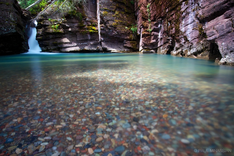 Pool on South Fork Mineral CreekSAN JUAN MOUNTAINS, COLORADO
Engineer Pass
Then I headed off through Silverton to Engineer Pass. There's nothing like the feeling you get when you're standing (or driving) on top of a mountain range. Engineer Pass is the type of place where camera doesn't matter. It really is like a sanctuary to me, to be "on top of the world" with nothing but God's creation all around...
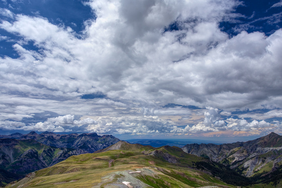 west side of Engineer Pass
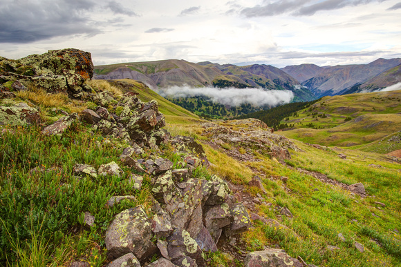 East Side of Engineer Pass
What a view. The next step in the journey was a change of plans...
Clear Creek
I was going to hike into the Uncompahgre Wilderness toward Wildhorse Peak for a shot of the sunset on Dragon's Back, but unfortunately this year the rains were unrelenting, and the sky was completely obliterated by clouds. So, reluctantly I decided to head down the east side of the pass and spend the night at Clear Creek Falls. I'd been there before, but the sky was clear, and it just didn't turn out well. This time, though, the skies were clouded just enough for an awesome morning...
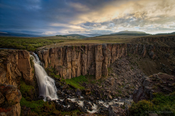 Dawn at North Clear Creek Falls
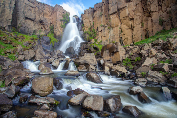 North Clear Creek Falls
And then a short trip just down the road to South Clear Creek Falls...
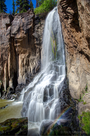 South Clear Creek Falls VI
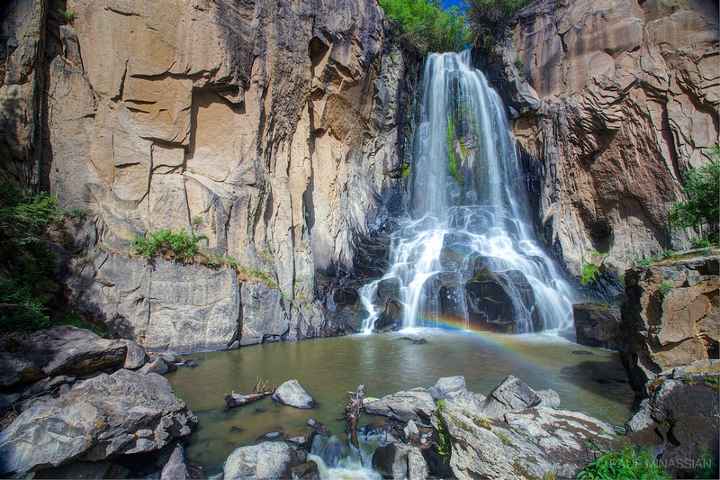 South Clear Creek Falls IV
Camp Redcloud & American Basin
So while I still want to get the sunset at Dragon's Back, I am very thankful for this detour. For more reasons than one, because my wife and little girls were spending the week at Camp Redcloud's Family Camp. So I got to head over there and spend a day with them! We had a blast together, and I spent the night there. What a fun time! The next day I was headed out over Cinnamon Pass, and thank the Lord my wife had signed the girls up for a day trip to American Basin — which is exactly where I was going! So I got to enjoy spending time with them in the basin as well, marveling at the beauty of God's wildflowers...
I love my family!
Beartown to Trinity
So the main event was to be a backpacking trip to Sunlight Basin. My route was from Beartown Trailhead over Hunchback Pass, up Trinity Creek to Trinity Lake, up and over the high passes to Sunlight Basin and then back up the Vallecito drainage back to Beartown. The trip started out pretty well, with a nice lunch stop at an unnamed waterfall and nice cascade on Vallecito Creek. Found out later this was the place to cross the Vallecito to head over to Trinity Creek...
 Falls on Vallecito Creek
 Vallecito Creek CascadeSAN JUAN MOUNTAINS, COLORADO
Sunlight Lost
Figuratively and literally. Unfortunately the rain/thunder/lightning was so relentless (try 6 hours straight each day) that I didn't want to chance the high passes past noon. I could have gone back down Trinity Creek, down Vallecito Creek, then up Sunlight Creek to the basin, but the timing was going to be off by a day I didn't have. So I reluctantly shortened the trip to climb a ridge south of Peak 3 for some shots of the sunrise on Trinity Creek Basin, Peak 3 and the Grenadiers. Note that these were clouds already formed before the sun rose. Knowing the San Juans, you can imagine what most of the day was like while I was out there. Sure did make for a beautiful sunrise...
 Grenadier Sunrise
 Dawn at Peak Three
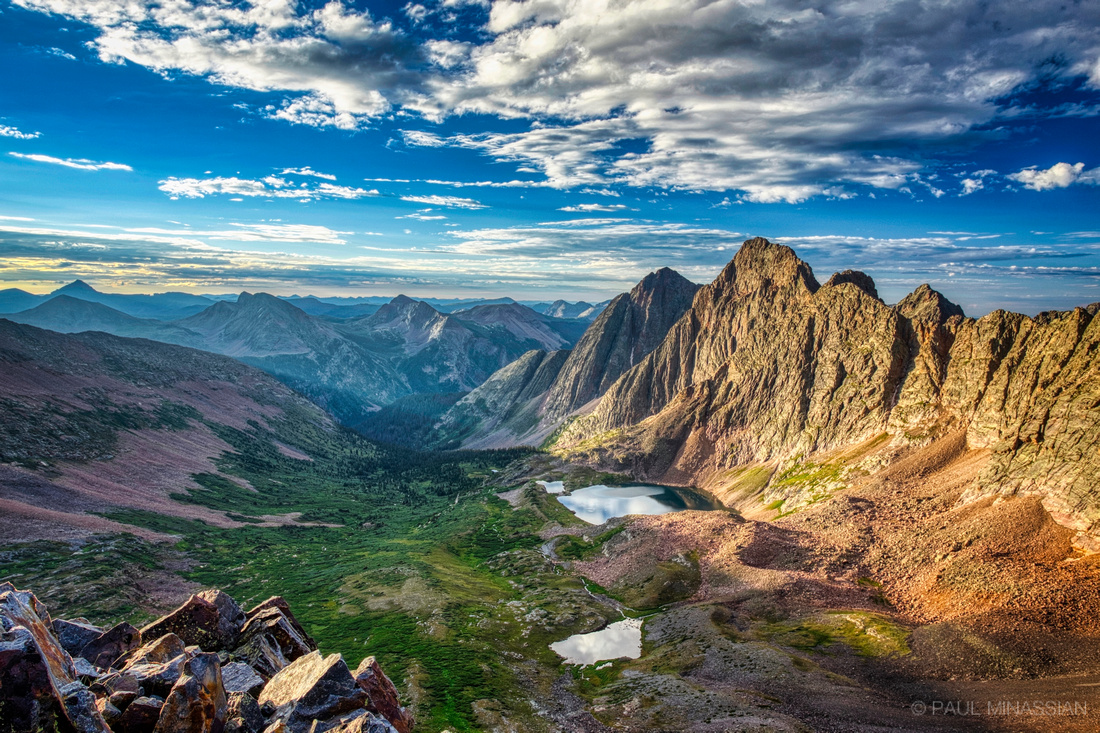 Sunrise in Trinity Basin
If you look real close, you can see a tiny white dot to the left of the biggest lake in the basin. That's my tent next to a big boulder. For a more detailed report of this trip, see my Trinity Basin journey report.
Final Thoughts
So while I didn't get to Sunlight Basin — my goal — I found some amazing places in spite of it. It's a good thing, because it reminds me of how God works in my life. I make my plans and think it's what's best, but ultimately He knows what He's doing, even when He changes my plans completely (which He does often).
Next year it's a toss-up between finally reaching Sunlight Basin or making a return trip to Titcomb Basin in the Wind River Range (now that I know my way around a camera a bit more).
]]> Dora Lake with storms moving off in the distance.
This was anything but easy.
I had seen some cool photos online of Dora Lake in Colorado's Gore Range. I had also read getting there wasn't the simplest task in the world. So I decided to go for it.
Did I say it was anything but easy? 4000+ elevation change in about 5-6 miles over about 10 hours (if I include the multiple stops during the Colorado monsoon lightning storms that kept passing overhead). Bushwhacking through brutal undergrowth and downed trees. Physically, the hardest 2-day excursion I've ever taken, considering my age. When I was in my 20's, probably not a big deal.
The Eternal Climb
The journey starts at the Surprise Trailhead just east of Lower Cataract Lake (not too far from Dillon, Colorado). The trail is pretty easy for the first 3 miles to Surprise Lake. Soon after, it all gets ugly. At an unnamed creek crossing, I turned left off trail. And I do mean off trail. Thick undergrowth, tons of downed trees. And mosquitoes. Holy cow, the mosquitoes. Reminded me of the Sierra Nevada in early summer. Insane.
And all uphill.
To make a long story short, I'll just say several hours later I got to Dora Lake. I'll let the photos below do most of the talking. Mouse-over photos for brief descriptions...
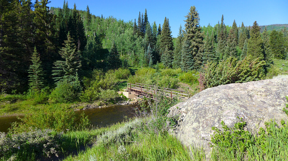 Trail's start and end.
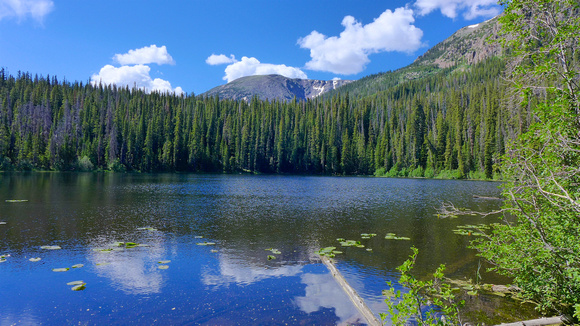 Surprise Lake
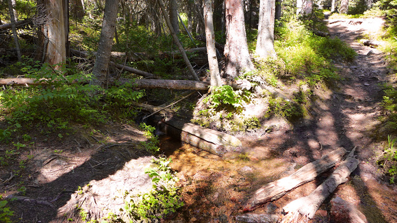 Trail to the right. I followed this unnamed creek into the forest to the left.
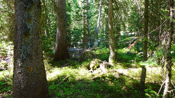 This is what I trudged through. Forever.
 Steep!
 Steep!!
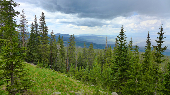
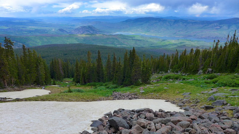 Finally above treeline. Green Mountain Res. in the distance.
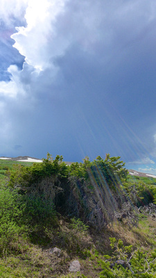 My tiny fortress in the midst of the hail storms. Not that it would have stopped lighting.
 Finally above treeline panorama. Green Mountain Res. in the distance.
Yes, lots of lightning/hail/rain rolled through, on and off the entire time. Once I was above treeline, it was just plain dumb (most likely) but I just kept plodding along. It was stupid crazy.
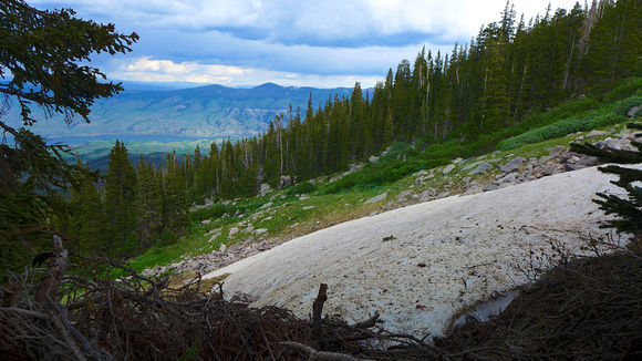
Just before you get to Dora Lake, there is a sloped snowfield that skirts a rather steep-sided chasm. So right when you feel like your legs are gonna fall off, you gotta go up and around the snowfield so you don't make a mistake and slide off into oblivion. Fun times...
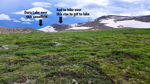 Wide "marsh" above treeline. In the distance is ridge above chasm leading to Dora Lake.
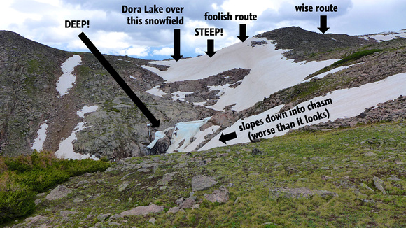 Dora Lake is over the snow-covered rise center frame. Chasm in between.
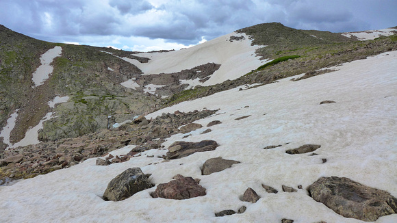 Snowfield slopes down into chasm to the left. Sketchy.
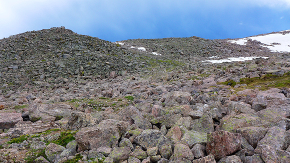 The final saddle. Had to go this route to avoid snowfield and chasm.
But somehow, when you (finally) top the final rise and Dora Lake comes into view, all the pain numbs just a bit, and that insane voice in the head of all landscape photographers says, "Yeah, it was worth it!"
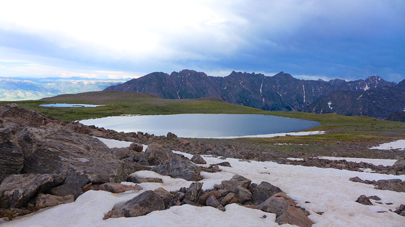 The bench that holds Dora Lake.
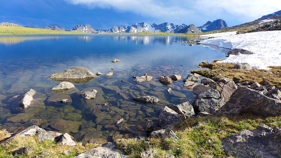 On the shore of Dora Lake.
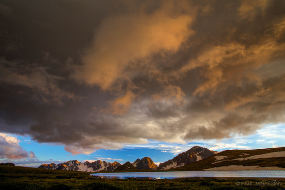
 Dora Lake with storms moving off in the distance.
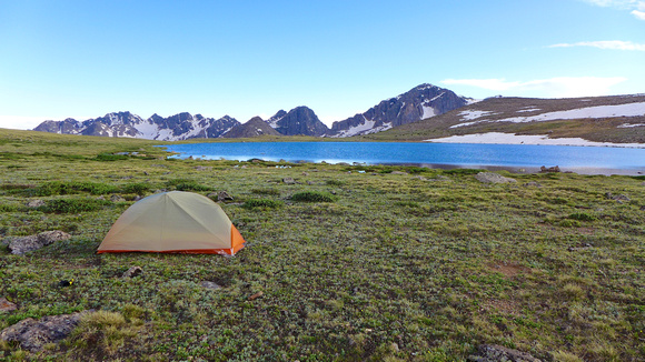 Campsite at Dora Lake.
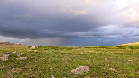 Dora Lake bench looking at storm to the east (tent left-center)
 Storms at Dora Lake. Note my tent near the rocky rise at the left.
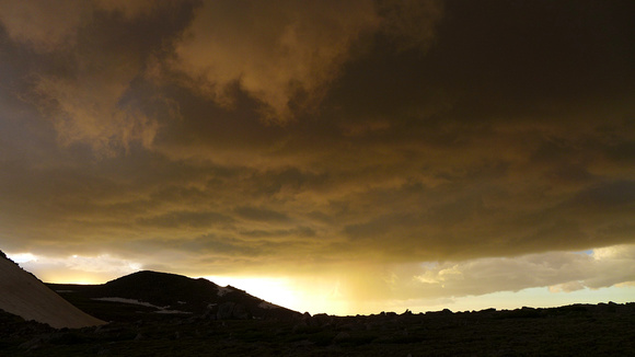 Waves of storms kept coming through sunset. Awesome!
Dora Lake
Dora Lake was beautiful. Remote. Unique. I loved the silent isolation of it. It's on a large, flat bench, so it feels like you're on top of the world. And you have it all to yourself...
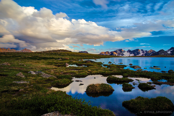 Dora Lake BluesGORE RANGE, COLORADO
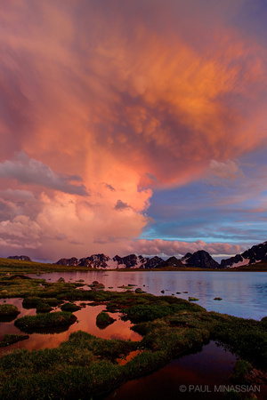
 Dora Lake After the StormGORE RANGE, COLORADO
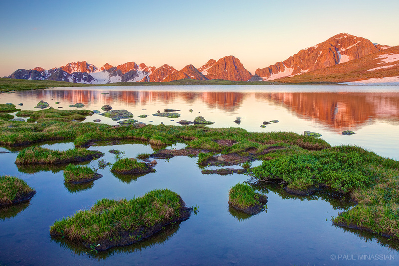
 Dora Lake GlowGORE RANGE, COLORADO
 Sunrise at Dora LakeGORE RANGE, COLORADO
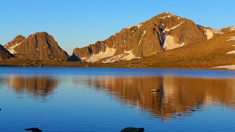 Mount Powell (right) at sunrise.
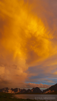 Dora Lake SkyfireGORE RANGE, COLORADO
Down, Down, Down
Groan. Grunt. Whimper. Down, down, down 4000+ feet. The very next day after going up. Yay. Going up I tried to stick to the creek. Going down I tried to angle to the left in the drainage to stay along the slight ridge, angling toward the trail (trying to hit it between Surprise Lake and the ridge above Upper Cataract Lake). Turns out the undergrowth and downed trees were worse that route. The mosquitoes were merciless. Utterly merciless. I couldn't stop moving else I'd get swarmed, but I desperately needed rest. I fell several times trying to lift my weary legs over the dead-falls. I kept going and going, wondering when I'd (ever) hit the trail...
 Panorama of chasm and Dora Lake.
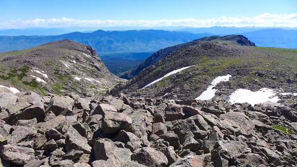 Chasm north of Dora Lake.
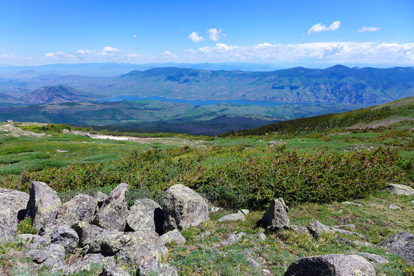 The way down. Green Mountain Res. in the distance.
 The way down panorama. Green Mountain Res. in the distance.
Painful Perspective
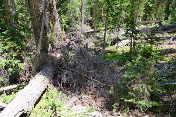 Insane undergrowth and dead-falls on the way back down.
For the first time in my life, I whimpered at the task at hand. I actually said aloud, "Lord, please get me out of this." I was literally running out of strength. Now, I knew the trail was before me, so I knew to just keep on going. But it really got me to thinking. I wonder what it's like for those lost in a jungle with no idea of where hope lies. Or those lost at sea with no idea of what direction to go to find salvation. Or even those who face such brutal circumstances in life that they just want reprieve, but there doesn't seem to be any hope on the horizon. And I understood why some people in such dire situations must surely give up. I truly had a slight glimpse into how brutal it must be.
If you have people in your life who are lost in a wilderness, I cannot guarantee that you can save them. But you can offer them a beacon, a light to guide them. I am convinced it is nothing short of the love of Christ. To me He is the ultimate, unfailing Beacon. The eternal Light. But yes, a beacon of light. Hope. Rest. Because if my glimpse of hopelessness in the midst of that forest is any indication, we have people all around us who are petrified and falling over and over in the darkness.
Rylie Saves the Day
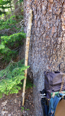 Rylie the Walking Stick
I need to take a moment to thank Rylie. Rylie really helped me through this entire journey. See, I had forgotten my trekking poles on this trip (NOT smart for such elevation gain). So early on in the hike, I spotted a pretty-close-to-perfect walking stick. Rylie assisted me all the way up, and all the way down. Rylie even sacrificed about 4 inches of length to save me from sure injury. When I was stumbling through the forest (on the way down) trying to locate the trail, I stepped over a large dead-fall that was right on the edge of about a 6-foot drop. I stepped onto a branch on the other side of the dead-fall, and it snapped, sending me careening forward, about to take a face-first, hard fall. Well, I threw out my arm holding Rylie, and Rylie took the brunt of it, and held me up long enough to give me time to spin around, tuck my shoulder and kind of roll down a couple feet. Saved me from a world of hurt. Rylie lost 4 inches at the top, but I brought her home and she now sits in honorable company with the other special walking sticks my daughters have brought home from various journeys. Why the name Rylie? Stands for Ry(an)L(ogan)(Jess)ie, my three wonderful ladies.
A Better Route?
So after getting home, I figured there might be a better way up and down along the ridge I tried to follow on the way down. I made the mistake of turning a bit too far to the east (right) and ended up dropping down off the ridge before I wanted to. Turns out there is (supposedly) a climber's trail up that very ridge. Next time, I'm gonna try to find it. IF there is a next time — although it's a challenge I feel the need to embrace...
]]>